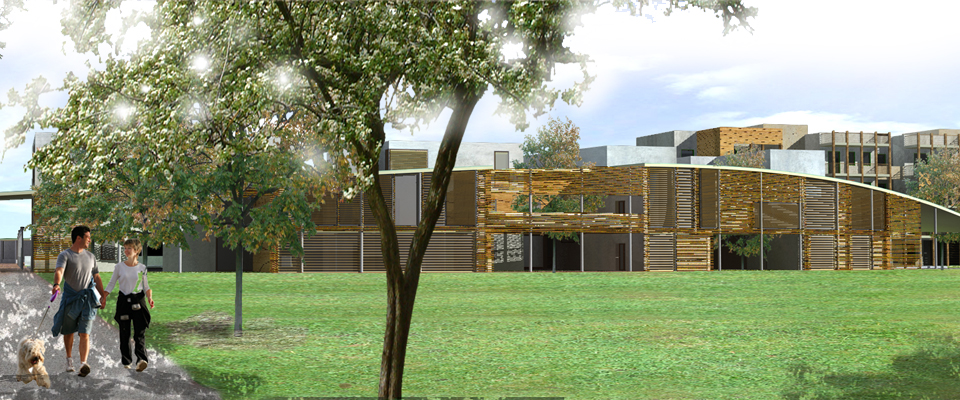
Territorial rehabilitation, social housing and neighbourhood facilities Project illustration: The following proposal has been marked within a national competition launched in Bologna by INU and WWF, according to a specific strategy which aimed at involving local inhabitants to take part to political decisions. The area is characterized by the presence of a rural landscape “relict” unexpectedly survived into the consolidated urban tissue, splitted into two half by the city ring highway, which is still today intensively cultivated. The design aim is to bridge both sides of this territorial enclave, to emphasize the existence of a natural void fenced by the urban fabric, an “oasis” into the “built desert”, to counteract conventional expectation into the urban landscape. The proposal therefore systematically gather all traces, both contemporary and historical, stacking them through different layers. By overlapping the different layers a new coherent hybrid tissue is obtained, where urban and rural aspects are merged. Sign of the original open landscape (roman “centuriatio”, flood plan, fruit three rows) and of the metropolitan area (industrial tissues, highways and high density scattered housing estate) are therefore glued to guide the new intervention, which encompass a new residential area and social facilities. New building quantities try to define a compact building border, to preserve the “green hearth” and reduce soil consumption. A system of different public spaces connect the new interventions with the proposal of the new University Department addressed to Motorial sciences. The strategy of bridging the two territorial borders is emphasized by overlapping the highway system with a new green soil and to underpass to multiply local access. The new urban park main street, a fragment of the old roman “centuriatio” system, is restored, lined by sport facilities and public facilities hosted within a “folie” system pointing a discontinuous territory.